

Residents in Cavite and nearby areas were urged to stay alert on Friday as the Philippine weather bureau PAGASA reported that a Low Pressure Area (LPA 6a) inside the Philippine Area of Responsibility (PAR) has a medium chance of developing into a tropical depression within the next 24 hours.
As of 2:00 PM on 06 June 2025, the LPA is being closely monitored, with the public advised to track updates from the Department of Science and Technology – PAGASA. While no active tropical cyclone currently threatens the country, the agency warns that the system could bring heavy rains, particularly over vulnerable areas such as Cavite, which may face possible flooding or landslides.
PAGASA’s Tropical Cyclone Threat Potential Forecast, valid for the period of 06–12 June 2025, indicates:
- No active tropical cyclone within PAR as of issuance time.
- A potential tropical cyclone-like vortex (TCLV1) may develop over the Philippine Sea during the first forecast week.
- The chance of TCLV1 intensifying into a full-blown tropical cyclone remains moderate to low.
- A second TCLV (TCLV2) may also form in the western section of PAR, though its cyclone development potential is currently low.
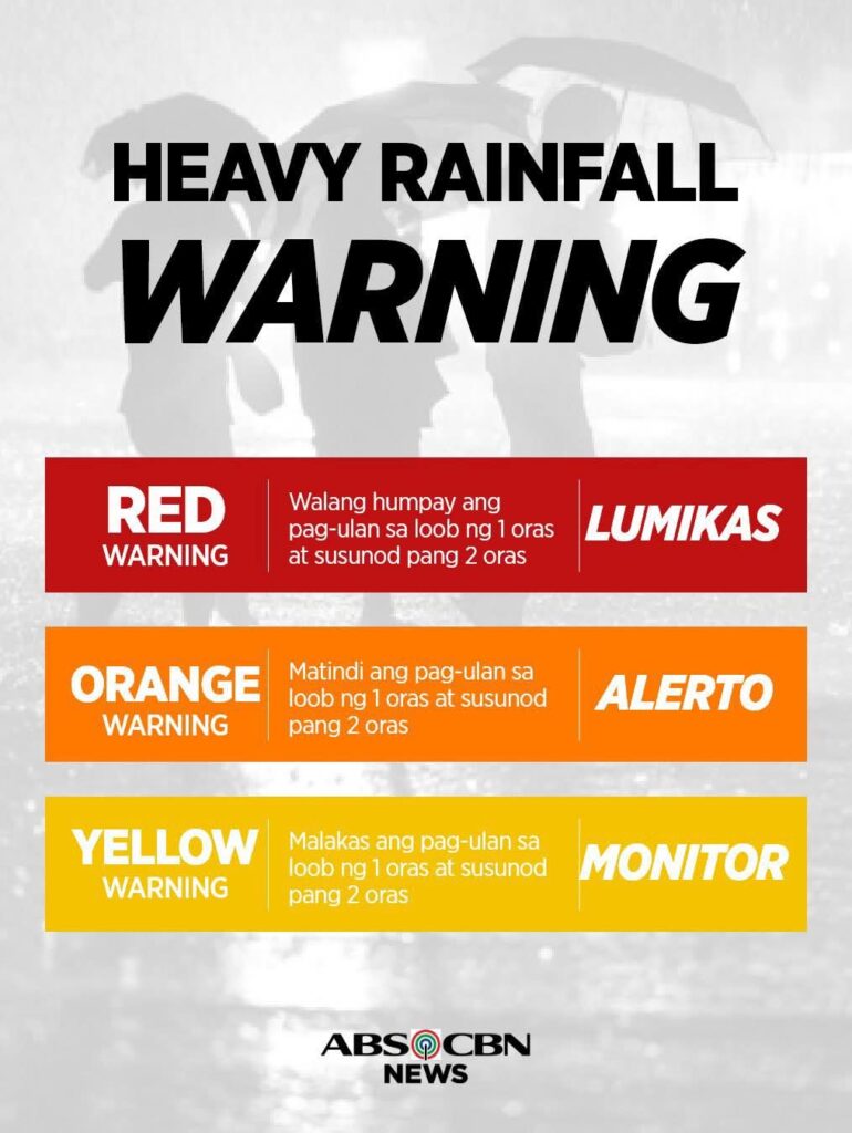
Meanwhile, the Rainfall Warning System remains in effect nationwide:
- Red Warning: Continuous heavy rain within one to two hours – Evacuate immediately.
- Orange Warning: Intense rainfall – Stay alert.
- Yellow Warning: Heavy rain likely – Monitor weather updates.
Local disaster offices and the general public, especially in low-lying and flood-prone areas such as Cavite, are advised to prepare for possible emergency measures and monitor PAGASA’s official advisories.
Forecasts are updated every Monday, Wednesday, and Friday. For the latest information, visit: 🔗 https://bit.ly/TCTHREATDOSTPAGASA
🔗 https://bit.ly/S2SDOSTPAGASA
For inquiries:
📞 (02) 8284 0800 local 4921 / 4920
📧 [email protected]
Discover more from Cavite News
Subscribe to get the latest posts sent to your email.


